
GSMaP: Monitoring Rainfall from Space to Protect Communities
Of all the Earth’s natural processes, rainfall is perhaps the one that has the most significant influence on our everyday lives. Yet as the climate changes, patterns in rainfall are becoming increasingly unpredictable, meaning it is now more critical than ever to monitor precipitation from space. The Global Satellite Mapping for Precipitation (GSMaP) project, founded by researchers from institutions across Japan, is doing just that. Through a combination of orbiting satellites and advanced algorithms, the project is now providing the global region with highly-resolved data on rainfall.
Changing Weather Patterns
Over previous decades, meteorological observations have made it clear that global climate change is having an increasingly severe impact on the weather – raising the frequency of extreme events including droughts and flooding. The effect has already been felt particularly strongly in the Asia-Pacific region, where almost two million people have been killed in weather-related disasters between 1970 and 2011, comprising 75% of all casualties globally. To monitor how weather patterns are changing, and to gain knowledge of how to mitigate their worst effects, it is becoming increasingly important to precisely monitor patterns in rainfall from space.
‘Satellite observation is a unique and effective tool to cover a large area in a short time,’ says Dr Takuji Kubota, a researcher at the Japanese Aerospace Exploration Agency (JAXA). ‘Its advantage is obvious when it observes geophysical parameters that vary both temporally and horizontally, like rainfall.’
Because weather events are typically highly sporadic, satellites are far better at monitoring them than ground-based techniques. ‘Without satellite observations, it is difficult to gain distribution of rainfall over the whole globe,’ Dr Kubota continues. ‘Rainfall observations by rain gauges and ground rain radars only cover small areas of the global Earth’s surface, since regions over land areas where people don’t live, and oceans are difficult to access.’ Now, Dr Kubota and a group of researchers from institutions across Japan are finding solutions to these issues, as part of the Global Precipitation Measurement (GPM) mission.
Designing an Effective Monitoring System
The first task of the GPM team was to design a satellite-based system that could accurately monitor patterns in rainfall on scales of continents. Clearly, this would be a tall order, but through their research, Dr Kubota and his colleagues found that their aims could be achieved by combining data from passive microwave sensors in low-Earth orbit, with the data gathered by infrared radiometers in geostationary orbit. In collaboration with JAXA, the National Aeronautics and Space Administration (NASA), and international agencies, the GPM researchers then developed specialised algorithms that can combine the data from these satellites, to produce a near-real-time map of rainfall.
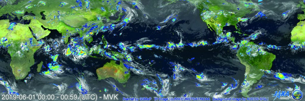
As Dr Kubota explains, the end result of this research has been hugely successful so far. ‘The Global Satellite Mapping for Precipitation (GSMaP), developed by JAXA as part of the GPM product, provides high-resolution and high-frequency global rainfall maps based on multi-satellite passive microwave radiometer observations,’ he says. GSMaP began its real-time precipitation monitoring in 2007 as ‘JAXA Global Rainfall Watch’ (https://sharaku.eorc.jaxa.jp/GSMaP/index.htm), clearly demonstrating a greatly improved precipitation monitoring system compared with earlier techniques. By accessing the JAXA’s home page, GSMaP data will provide critical insights into significant rainfall-related disasters to strike all over the world, including the Asia-Pacific region.
GSMaP in South-East Asia
A few years ago, in November and December of 2014, Thailand and Malaysia were hit with extremely high levels of rainfall, causing widespread flooding, and increasing the risk of landslides. As a region that remains hot and humid all year round, South-East Asia typically experiences heavy monsoons each year, but with climate change, the risk of dangerously high levels of rainfall is now increasing.
GSMaP data allowed researchers to pinpoint exactly when and where rainfall was strongest during the event. The assessment provided both governments and local communities with information that helped them to make critically important decisions about how best to focus their efforts to mitigate the worst effects of the extreme rainfall. Again, the researchers demonstrated how valuable space-based precipitation measurements can be.
In fact, the Meteorological, Climatological, and Geophysical Agency (BMKG) in Indonesia obtains GSMaP data and displays it as an image. GSMaP data are also used for the analysis of hourly and daily rainfall accumulation to verify weather forecasts, as well as meteorological hazard analysis. To support operational weather forecasts and warnings, GSMaP-derived products have been extended for other purposes, such as drought and forest fire potential monitoring.
The Hydro-Informatics Institute (HII) in Thailand developed methods to use the GSMaP data in their flood forecasting system and rainfall monitoring system. GSMaP data are used as input variables for the flood forecasting system to simulate more realistic runoff. HII’s rainfall monitoring information is used by stakeholders and water related agencies; it has been posted on their website since January 2017.
‘Since its data release, GSMaP data has been used by various users for various purposes, such as rainfall monitoring, flood alert and warning, drought monitoring, crop yield forecast, and agricultural insurance’
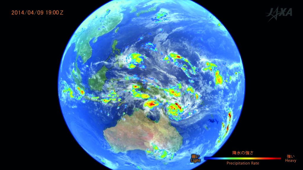
Rainfall distribution by GSMaP (colour) at 19:00 on 9th April, 2014. CREDIT: JAXA
Launching GPM’s Core Satellite
Although the data gathered by GSMaP had already proved to be incredibly useful, the GPM researchers aimed for even higher degrees of precision in their data. This would only be achievable by sending an additional specialised satellite into space. In 2014, JAXA and NASA sent the GPM core satellite with two instruments into orbit – one to passively monitor microwave signals, and the other equipped with a dual frequency precipitation radar. The core spacecraft serves as a calibration standard for the other members of the GPM constellation, which would study precipitation in the global region in unprecedented levels of detail.
Using information derived from the GPM core satellite, Dr Kubota and his colleagues updated GSMaP’s algorithms to allow for more accurate real-time images with spatial resolutions of 0.1 degrees in both latitude and longitude, and with temporal resolutions of just 1 hour. With these improvements, GSMaP was now able to measure quantities including hourly precipitation, and the percentage of rainy days throughout the year, for the global region as a whole. Such sophisticated capabilities have meant that GSMaP can now provide researchers with critical information about a diverse array of potential hazards caused by extreme rainfall.
Diverse New Measurement Capabilities
GSMaP now provides people from 122 countries with precipitation information that is crucial to protecting their lives and livelihoods. ‘Since its data release, GSMaP data has been used by various users for various purposes, such as rainfall monitoring, flood alert and warning, drought monitoring, crop yield forecast, and agricultural insurance,’ Dr Kubota describes. As well as general rainfall and drought monitoring, these capabilities can be divided into several broader themes.
Firstly, GSMaP applications can provide information about hydrology – a field that encompasses flood forecasting, analysis and risk management. In addition, they can predict landslide risks created by model predictions and send out early warning messages. Secondly, GSMaP can monitor numerous risks to agriculture, by measuring quantities including drought index, in particular patches of farmland – all of which can be used to determine the growing outlook for particular crops.
Finally, the data can be used to assess risks to public health, through the spread of tropical diseases including malaria and dengue fever. Since rainfall can have direct effects on the breeding of mosquitos and other parasites, GSMaP has helped researchers to predict how likely these diseases are to infect particular localised communities. This broad set of measurement capabilities is now providing the global region, and the many diverse populations it represents, with the highly-resolved precipitation satellite data.
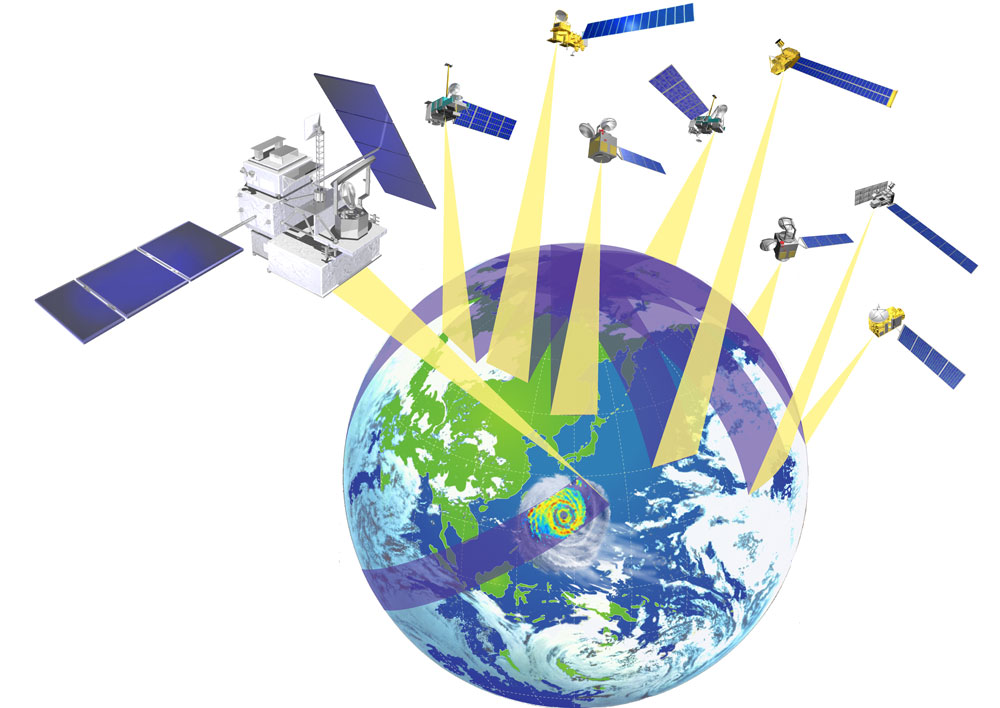
A concept of the Global Precipitation Measurement (GPM) mission: A GPM core satellite and constellation satellites. CREDIT: JAXA
Critical Information for Communities
Having demonstrated the diverse capabilities of their satellite system, the GSMaP team has now joined forces with several other weather monitoring organisations. ‘In particular, the GSMaP data are now used by the Space-based Weather and Climate Extremes Monitoring Demonstration Project (SEMDP), led by the World Meteorological Organisation, to enhance the capacity of National Meteorological and Hydrological Services for monitoring drought and heavy rainfall – assisting governments and local communities with informed decision making to help them adapt to climate variability and change,’ Dr Kubota concludes.
Along with these humanitarian efforts, Dr Kubota and his colleagues are now aiming to further improve their algorithms to achieve even more precise precipitation data, with the newest version of the software scheduled for release in early 2020.
As the Earth’s atmosphere becomes warmer, many climatologists are predicting that the effects of rainfall extremes will become increasingly severe in the coming decades. As this happens, GSMaP’s data will be crucially important to billions of people around the world. Using the satellite system’s high-resolution, real-time precipitation images, communities will be able to assess how their livelihoods will need to adapt to a changing climate, and how to avoid the worst effects of the rainfall-related disasters it will bring.
Reference
https://doi.org/10.33548/SCIENTIA392
Meet the researcher
Dr Takuji Kubota
Earth Observation Research Center
Japan Aerospace Exploration Agency
Tsukuba city, Ibaraki
Japan
Dr Takuji Kubota completed his PhD in Earth and Planetary Sciences at Kyoto University in 2004. Since 2007, he has worked for the Japan Aerospace Exploration Agency (JAXA), where he now participates a wide variety of projects run by JAXA, including the Tropical Rainfall Measuring Mission, Global Precipitation Measurement, Earth Cloud, Aerosol and Radiation Explorer missions. Dr Kubota has received several awards in both Japan and the US, including the Meteorological Society of Japan’s Gambo-Tatehira Award in 2019 for ‘Achievements related to development of global precipitation map by satellite observations and promotion of its applications in society’.
CONTACT
W: https://sharaku.eorc.jaxa.jp/GSMaP/index.htm
FUNDING
JAXA GPM mission
KEY COLLABORATORS
Dr Kazumasa Aonashi, Japan Meteorological Agency
Professor Tomoo Ushio, Tokyo Metropolitan University
Professor Shoichi Shige, Kyoto University
Professor Yukari N. Takayabu, University of Tokyo
Tomohiko Higashiuwatoko, Remote Sensing Technology Center of Japan
![]()
Creative Commons Licence
(CC BY 4.0)
This work is licensed under a Creative Commons Attribution 4.0 International License. 
What does this mean?
Share: You can copy and redistribute the material in any medium or format
Adapt: You can change, and build upon the material for any purpose, even commercially.
Credit: You must give appropriate credit, provide a link to the license, and indicate if changes were made.
More articles you may like
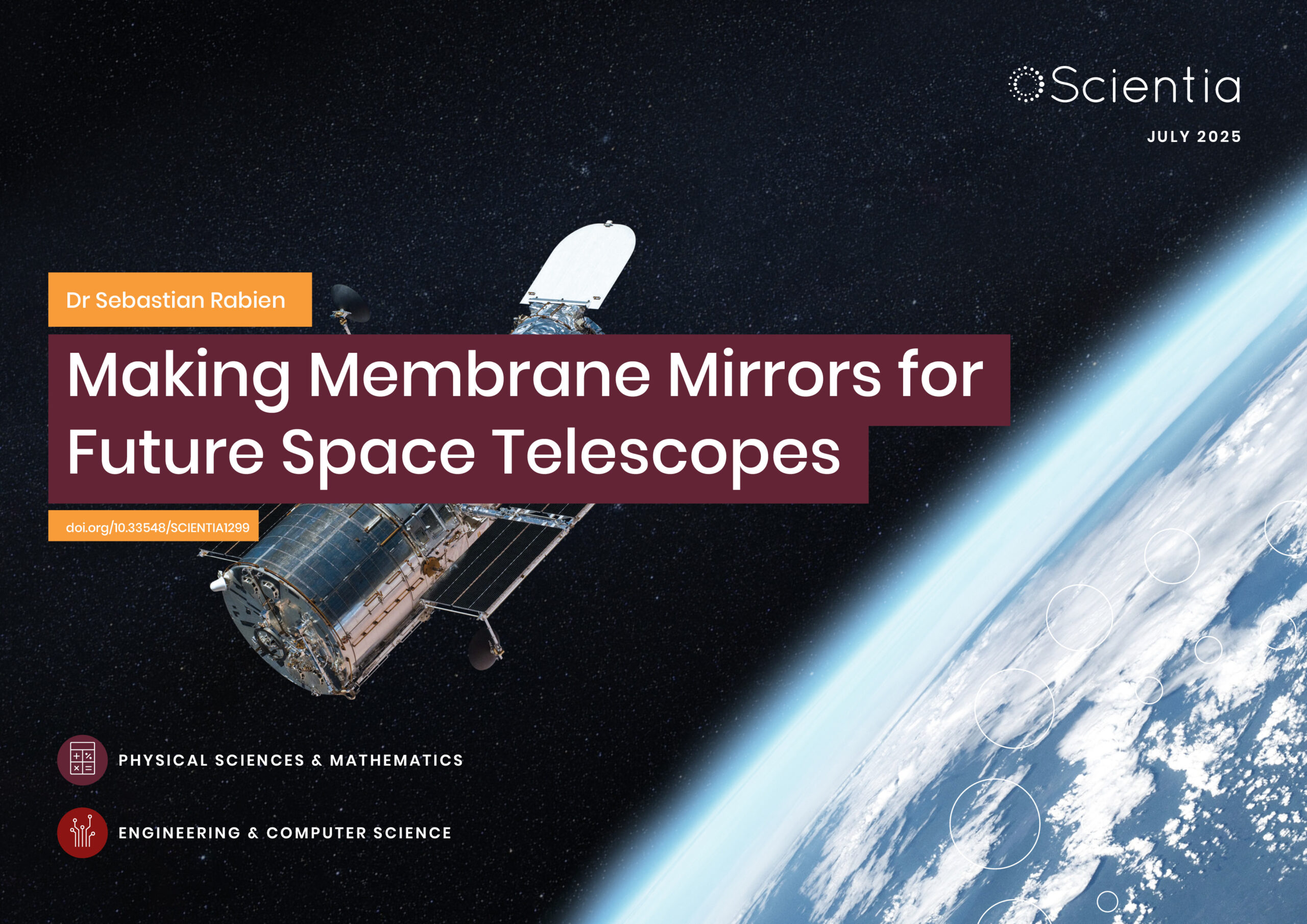
Dr Sebastian Rabien | Making Membrane Mirrors for Future Space Telescopes
Mirrors play a key role in space telescopes, but to keep increasing the scale of this technology, mirrors need to be light and compact, so they can be transported in spacecraft, but also able to be adaptively corrected and controlled to ensure their accuracy. Dr Rabien and his colleagues from the Max Planck Institute for Extraterrestrial Physics, in Germany, have developed a technique to make extremely thin and lightweight mirrors, which can then be controlled with adaptive optics, making them a potential solution for larger space telescopes.
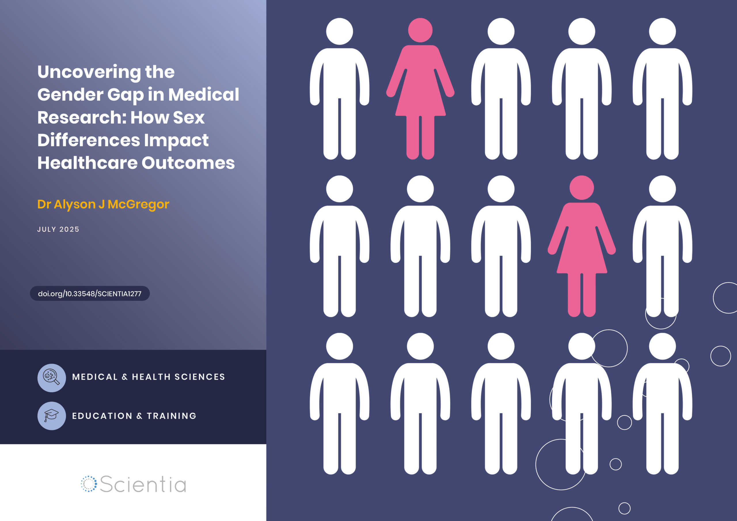
Dr Alyson J McGregor | Uncovering the Gender Gap in Medical Research: How Sex Differences Impact Healthcare Outcomes
Medical research has historically focused predominantly on male subjects, leading to dangerous gaps in our understanding of how diseases and treatments affect women. Dr Alyson McGregor from University of South Carolina School of Medicine Greenville has devoted her career to addressing this critical issue, highlighting how biological sex differences impact health outcomes. Her work demonstrates that ignoring these differences can have life-threatening consequences and advocates for more inclusive research practices to ensure safe and effective healthcare for everyone.

How Food Environments Shape Our Eating Habits
How we eat dramatically impacts our health, yet millions of Americans live in ‘food deserts’ – areas with limited access to fresh, nutritious food. Recent research reveals that solving this crisis requires looking beyond just physical access to food to understand how our entire community environment shapes our dietary choices. Through a series of pioneering studies, Dr Terrence Thomas and colleagues at North Carolina A&T State University have been investigating how different aspects of our food environment influence what we put on our plates. Their findings suggest that creating lasting change requires reimagining how communities engage with food at every level.

Probing Electron Dynamics in the Ultrafast Regime
In the atoms that make up the matter around us, negatively charged particles called electrons have properties such as spin and orbital angular momentum. Researchers at Martin Luther University Halle-Wittenberg have developed a theoretical framework which allows them to simulate the dynamics of the spin and orbital angular momentum of electrons in materials when probed with an ultrafast laser pulse. Using this framework, they are able to simulate different materials and improve our understanding of dynamics on an atomic scale.