
Dr Athos Agapiou | Dr Vasiliki Lysandrou | Dr Nicholas Kyriakides – New Tools for Probing Ancient Cypriot Architecture and Landscape
New advances in image processing allow fascinating new insights to be gleaned from archived aerial images, and studies of both new and ancient seismic events are giving us a new understanding of the ancient world and how to preserve what remains. Dr Athos Agapiou, Dr Vasiliki Lysandrou, and Dr Nicholas Kyriakides, all from the Cyprus University of Technology, are embracing this blend of scientific fields in Cyprus in their fascinating investigations of ancient tombs.
Finding, Understanding, and Preserving Archaeological Sites
Understanding and preserving the past is a complex and demanding task. Archaeology is about far more than digging trenches, hoping to unearth treasures. Before any excavation can begin, promising sites must first be located and catalogued, and the surrounding geology must be studied and understood. Once excavation has been completed, the question then remains of how best to protect and preserve what was uncovered.
To tackle some of these challenges, Dr Athos Agapiou, Dr Vasiliki Lysandrou, and Dr Nicholas Kyriakides from the Cyprus University of Technology are utilising a range of techniques to find, understand, and preserve archaeological sites. Drawing on a broad and comprehensive skill set, they are investigating ways to locate ancient tombs and what seismic events they have survived.
The study of these structures is incredibly useful not only from a cultural but also a geological and historical perspective. Ancient tombs of the Hellenistic and Roman eras are underground, sturdy structures, allowing them to survive events that may have destroyed buildings on the surface. As such, they can hold vital clues to help piece together a better understanding of the culture that built them and the subsequent events that may have destroyed them.
Locating Sites of Historical Importance
The first challenge for archaeologists is locating a site of historical importance. Historical records often give hints to potential locations, and specially chartered aerial surveys can search large areas looking for tell-tale clues. However, in areas where these surveys have not been undertaken and records are patchy, this process can be difficult.
Cyprus has not had a dedicated archaeological aerial survey, so Dr Lysandrou and Dr Agapiou turned to photographs taken as part of the Department of Lands and Surveys land management surveys. These photographs were not designed to be used to find buried ruins, but through careful analysis, Dr Lysandrou and Agapiou hope to identify surface features indicative of buried tombs and other monuments.
Dr Lysandrou and Agapiou used aerial photographs of an ancient burial ground cemetery in Nea Paphos. Whilst the site was excavated in the 1980s, a photo from 1960 showed the site long before excavation began. This makes it the perfect site to analyse photographs to identify surface features corresponding to buried architecture. To begin their analysis, they used a series of programs to digitise, filter, orient, and enhance the photo. This allowed them to fit the photo to existing digital terrain scans and highlight the features they hoped to find.
After this process, Dr Lysandrou and Agapiou started to map out archaeological markers on the photo with the location of the tombs they knew lay just beneath the surface. With a set of surface markers, they then ran programmes that detected repeating shapes and found archaeological markers in places that had not yet been excavated, hinting that there may be more to uncover in the area. Whilst the programmes struggled in areas where there was denser vegetation, this method was able to reveal a wealth of information from a photograph that was not deliberately taken for archaeological purposes. Excitingly, this suggested that by digitising and scanning other aerial archives, completely new sites could be unearthed.
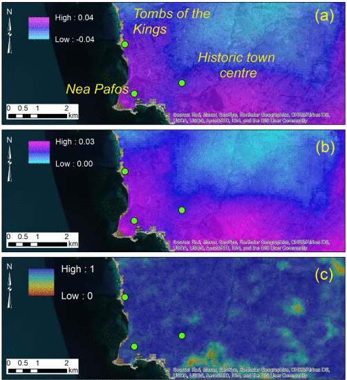
Credit: Athos Agapiou
Earthquakes and Sites of Archaeological Importance
Earthquakes can be hugely destructive, and in a seismically active area such as Cyprus, it is important to assess the risk of a seismic event occurring at sites of archaeological importance. To achieve this, researchers are turning to ancient tombs to study the frequency and severity of earthquakes in antiquity.
Dr Kyriakides, Dr Lysandrou and Dr Agapiou have been studying the damage to ancient tombs from earthquakes to try and work out how at risk these sites are from future seismic events. The first challenge was to use the construction methods, geometry, and depth of the tombs to determine their resistance to seismic events. This involved careful measurement of the tombs and mapping the cracking patterns in the walls. Using these measurements, the tomb geometry was loaded into a digital environment along with data on the surrounding geology to use as the basis for a computer algorithm to test its ability to withstand earthquakes.
Using these simulations, the team was able to calculate the seismic events these tombs would be most vulnerable to, and which would cause the pattern of cracks seen in the walls. From this, they could then calculate the seismic events these tombs had been subjected to, and work out a rough idea of how frequently damaging earthquakes occurred. These simulations also gave an idea of which sorts of events caused the most damage, and how. This allows professionals in conservation to decide the appropriate measures to be taken to effectively protect the tombs in future seismic events.
Dr Agapiou and Dr Lysandrou have also been working on data gathered on more modern earthquakes. By studying satellite data of areas of archaeological interest, they have been able to see the impact that an earthquake has on a given area. Previously, the analysis of this data would have taken a long time, but with new advances in cloud-based computing, researchers are quickly able to analyse the data for any damage to the site. Additionally, as the number of satellites capable of gathering this data increases, researchers can quickly gather and analyse data on a specific site soon after an earthquake. This allows the quick assessment of any potential damage to a site without having to make the physical journey to what may be a remote and difficult to reach location, although the team does say that this cannot replace in-person inspection of any potential damage.
Employing these aerial and satellite methods, Drs Agapiou, Lysandrou, and Kyriakides have been able to uncover a wealth of information about the funerary architectures lurking beneath the surface of Cyprus. Using this information, they can find, monitor the health of, and suggest protection measures for structures that have been lost for thousands of years. Their exciting work is paving the way for the protection and preservation of these important historic sites for generations to come.
SHARE
DOWNLOAD E-BOOK
REFERENCE
https://doi.org/10.33548/SCIENTIA932
MEET THE RESEARCHERS
Dr Athos Agapiou
Assistant Professor
Department of Civil Engineering and Geomatics
Cyprus University of Technology
Cyprus
Dr Athos Agapiou gained his PhD in Remote Sensing Archaeology from the Cyprus University of Technology in 2013. His current research interests are focused on Earth Observation and Geoinformatics in relation to archaeology. In 2018, he received the internationally recognised Young Researcher Award at the Cyprus Research Awards. He has also been awarded numerous scholarships from prestigious organisations, including the Alexandros S. Onassis Foundation, the Greek State Scholarship Foundation, and the Technical Chamber of Greece. In 2022, he became Deputy Director of the UNESCO Chair of Digital Cultural Heritage. In this position, Dr Agapiou aims to advance the field of digital cultural heritage while also working to digitally archive and preserve historical artefacts and landmarks.
CONTACT
E: athos.agapiou@cut.ac.cy
W: https://www.cut.ac.cy/faculties/fet/ceg/staff/athos.agapiou/?languageId=1
Dr Vasiliki Lysandrou
Researcher
Department of Civil Engineering and Geomatics
Cyprus University of Technology
Cyprus
Dr Vasiliki Lysandrou was awarded her PhD in Mediterranean Archaeology from the University of Cyprus. With a particular interest in funerary architecture and monument restoration and preservation, Dr Lysandrou’s work bridges the gap between engineering and humanities, using computational methods in the field of cultural heritage. This includes the processing of archived aerial photographs to geolocate unpublished and undiscovered Hellenistic tombs, using satellite images, space-based sensing, and geospatial tools for coastal archaeology, and the analysis of commercially available digital media to assess cultural landscapes.
CONTACT
E: vasiliki.lysandrou@cut.ac.cy
W: https://www.cut.ac.cy/faculties/fet/ceg/staff/vasiliki.lysandrou/?languageId=1
Dr Nicholas Kyriakides
Assistant Professor
Department of Civil Engineering and Geomatics
Cyprus University of Technology
Cyprus
Dr Nicholas Kyriakides gained his PhD from the University of Sheffield in the Seismic Risk Assessment of Reinforced Concrete (RC) Buildings. Dr Kyriakide’s research looks at the potential for damage in RC structures caused by seismic activity and how to repair a building after a seismic event or, even better, strengthen it beforehand. He has been studying how to retrofit buildings with modern materials to improve their strength, and the addition of materials to concrete (for example, recycled rubber from tyres) to improve energy absorption. He is currently head of the laboratory for Structural Assessment and CoAssessment and Concrete Construction Innovations at the Cyprus University of Technology, and served as Vice President for the Central Board of Directors of the Cyprus Association of Civil Engineers.
CONTACT
E: nicholas.kyriakides@cut.ac.cy
W: https://www.cut.ac.cy/faculties/fet/ceg/staff/nicholas.kyriakides/?languageId=1
FUNDING
This work was conducted as part of the ENGINEER project. ENGINEER received funding from the European Union’s Horizon Europe Framework Programme (HORIZON-WIDERA-2021-ACCESS-03, Twinning Call) under grant agreement No. 101079377 and the UKRI under project number 10050486. However, the views and opinions expressed are those of the researchers only and do not necessarily reflect those of the European Union or the UKRI. Neither the European Union nor the UKRI can be held responsible for them.
PROJECT RESOURCES AND SOCIAL MEDIA
W: https://engineer-twinning.eu/
T: https://twitter.com/ENGINEER_EUPro
F: https://www.facebook.com/people/Engineer-project/100094051237761/
FURTHER READING
A Agapiou, V Lysandrou, Detecting Displacements Within Archaeological Sites in Cyprus After a 5.6 Magnitude Scale Earthquake Event Through the Hybrid Pluggable Processing Pipeline (HyP3) Cloud-Based System and Sentinel-1 Interferometric Synthetic Aperture Radar (InSAR) Analysis, IEEE Journal of Selected Topics in Applied Earth Observations and Remote Sensing, 2020, 13, 6115–6123, DOI: https://doi.org/10.1109/JSTARS.2020.3028272
V Lysandrou, A Agapiou, The Role of Archival Aerial Photography in Shaping Our Understanding of the Funerary Landscape of Hellenistic and Roman Cyprus, Open Archaeology, 2020, 6(1), 417–433. DOI: https://doi.org/10.1515/opar-2020-0117
N Kyriakides, V Lysandrou, A Agapiou, et al., Correlating damage condition with historical seismic activity in underground sepulchral monuments of Cyprus, Journal of Archaeological Science: Reports, 2017, 14, 734–741. DOI: https://doi.org/10.1016/j.jasrep.2016.07.007
![]()

![]()
REPUBLISH OUR ARTICLES
We encourage all formats of sharing and republishing of our articles. Whether you want to host on your website, publication or blog, we welcome this. Find out more
Creative Commons Licence (CC BY 4.0)
This work is licensed under a Creative Commons Attribution 4.0 International License. 
What does this mean?
Share: You can copy and redistribute the material in any medium or format
Adapt: You can change, and build upon the material for any purpose, even commercially.
Credit: You must give appropriate credit, provide a link to the license, and indicate if changes were made.
SUBSCRIBE NOW
Follow Us
MORE ARTICLES YOU MAY LIKE

Dr David Hansen – Abhishek Juneja | Coming of Age: Active Balancing in Adolescence
Adolescence, the transitional stage between childhood and adulthood, comes with challenges as well opportunities for growth and learning.

Professor Deanna Sellnow | How Strategic Communication Can Save Lives When Crisis Hits
Professor Deanna Sellnow from Clemson University argues that crisis and risk communication research must evolve beyond simply describing and deconstructing problems to actively empowering people protect themselves and their communities. In an era of increasing globalisation, she proposes that researchers adopt learner- and learning-centered approaches to ensure communication does not simply inform people about dangers, but also teaches them how to respond effectively (e.g., to reduce risks, mitigate harms, improve safety, save lives) and why.
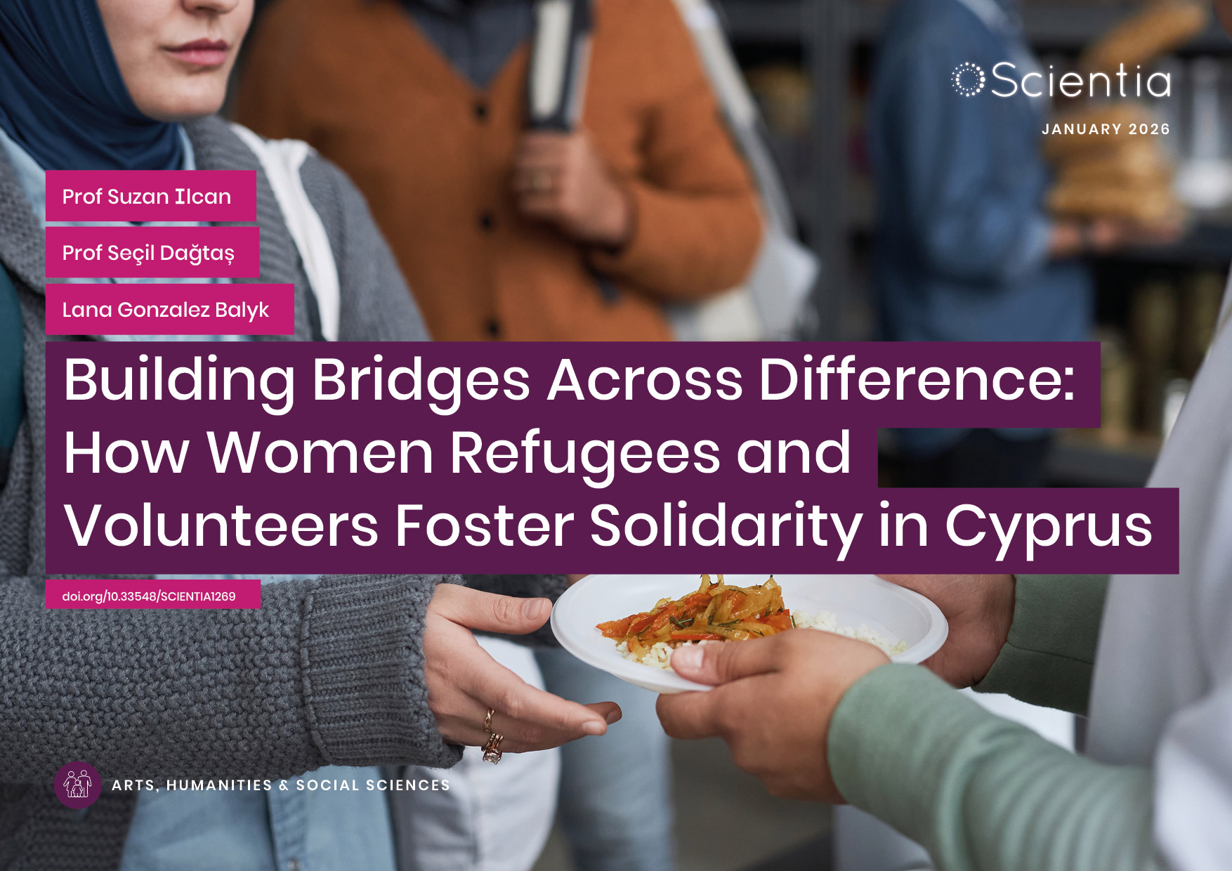
Dr Suzan Ilcan | Building Bridges Across Difference: How Women Refugees and Volunteers Foster Solidarity in Cyprus
Across Europe, refugees and asylum seekers often find themselves in precarious situations, facing limited access to housing, employment, education, and legal protection. While government responses have frequently proved inadequate, grass-roots movements have emerged to fill the gaps. These citizen-led initiatives represent more than simple charity; they embody new forms of political engagement where refugees and volunteers work together across differences to create useful change.
This issue is particularly pressing in the Republic of Cyprus (RoC), where the island’s own history of division and displacement shapes contemporary responses to newcomers. Since 2015, the RoC has experienced a dramatic increase in refugee arrivals, making it the EU member state with the highest number of asylum applications per capita in 2021. Yet despite – or perhaps because of – this pressure, women in the Cypriot city of Paphos have created remarkable spaces of collaboration and mutual support.

Prof Han Lamers | How Early Modern Scholars Used Ancient Greek to Shape Their National Identities
In early modern Europe, ancient Greek was far more than a scholarly pursuit. Intellectuals from many regions discovered that demonstrating resemblance of their native languages to Greek could elevate their cultural status, support claims of superiority over rival languages, and even advance religious and political causes. Sometimes called ‘Hellenising’, this phenomenon saw scholars from Italy to France, Germany, and the Netherlands, deliberately revealing —and often inventing— Greek features in their mother tongues.
Understanding how this worked requires examining specific cases where scholars used Greek to reshape their languages and advance their own agendas.