
Dr Fiona Darbyshire | Ear to the Ground: How Earthquakes Reveal Earth’s Ancient History
Earthquakes are one of the more destructive phenomena we encounter on Earth. However, the seismic waves that earthquakes send travelling through the Earth are powerful tools to investigate the Earth’s crust and mantle. Through a series of seismic recording stations in Canada and northern USA, Dr Fiona Darbyshire at the Université du Québec à Montréal is doing exactly that. By listening to the seismic waves emitted from earthquakes, she and her team can determine the current composition of the crust and upper mantle, while also revealing tantalising clues about the formation and evolution of tectonic plates over the planet’s long history.
Exploring the Lithosphere
On time-scales of millions of years, Earth’s crust is constantly moving and changing. Tectonic plates collide, causing mountain ranges to rise and rifts to deepen, and transforming the face of the planet. This movement is not only incredibly gradual, but is also concealed several thousand metres beneath our feet.
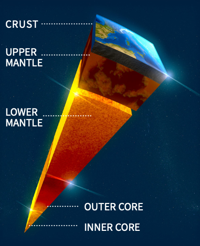
At this depth, it is impossible to simply dig a hole to investigate, so researchers need another method to reveal the dynamic processes within Earth’s lithosphere – the rigid layer that includes the crust and the upper portion of the mantle.
This is where earthquakes can provide a wealth of information. When an earthquake occurs, it transmits seismic waves from its origin through the interior of the Earth. As it travels through the Earth, the speed and direction of a seismic wave is affected by the density, depth, temperature and composition of the rock it passes through.
By building a series of seismograph stations, scientists can detect seismic waves caused by earthquakes. By comparing the data gathered from earthquakes at many ‘listening’ stations at diverse locations, they can build a picture that reveals the thickness, temperature and composition of Earth’s lithosphere, as well as the interaction between this solid outer-most layer and the flowing mantle beneath.
Dr Fiona Darbyshire at the Université du Québec à Montréal has used a suite of these listening stations across Canada, Greenland and north-eastern USA to study seismic waves. Her investigations have revealed critical insights into Earth’s lithosphere, and its evolution over billions of years.
‘I am a structural seismologist who uses the seismic waves from large global earthquakes, recorded by seismograph stations, to study the crust and upper mantle beneath these regions,’ says Dr Darbyshire. ‘Each large earthquake provides several complementary sources of information in the form of body waves and surface waves, all of which can be analysed in different ways to explore different aspects of Earth’s structure.’
Subsurface Observations
By listening to the rumbles of seismic activity, Dr Darbyshire and her colleagues build detailed maps of the geological features that lie deep underground.
The process of building a complete picture of these geological formations is a lengthy one, starting with the installation of a network of tens-to-hundreds of seismic listening stations. These stations are placed in a large array, often in remote locations where little data has previously been collected. Much of Dr Darbyshire’s work has involved installing and taking data from an array spanning more than 800 kilometres through Canada and the USA.
‘My collaborators and I have been actively involved in installing seismograph stations in areas of eastern and northern Canada and the northern USA that have suffered from a lack of adequate data coverage in the past,’ she explains. ‘These include distributed long-term installations as well as denser networks that target areas of particular scientific interest.’
Once installed, these arrays of seismograph stations are in operation for years at a time, detecting everything from large earthquakes to faint seismic rumbles. At the end of the data collection period, Dr Darbyshire and her team have the daunting task of processing all the data produced.
They use these data to determine the speed and direction of seismic waves as they travel through the Earth. From this, they can determine the subsurface structure of the Earth and reveal geological formations that are not observable at the surface. The waves caused by a seismic event will travel through the Earth with no major change in speed or direction until they meet an anomaly or boundary.
One such boundary is where the crust meets the mantle, called the Moho. By measuring the seismic waves bouncing off this boundary, Dr Darbyshire and her team can create a so-called Moho depth map.
Other features that will affect the passage of seismic waves include orogens, where the crust crumples and uplifts to form mountain ranges, and cratons, which are the remnants of ancient continental plates. By painstakingly going through all the data generated by the networks of seismograph stations, Dr Darbyshire identifies the remains of ancient tectonic collisions and interactions, giving us unique insight into Earth’s distant past.
‘Wave speed models reveal imprints of previous tectonic processes such as rifting and mountain-building events, or large-scale deformation,’ explains Dr Darbyshire. ‘I therefore use the models in conjunction with surface geology and tectonic reconstructions to understand the history of formation and evolution of the continental lithosphere over its multi-billion-year lifetime. In addition, some of the models can provide information about the interaction between the plate and the actively convecting mantle beneath, as well as the patterns of this mantle flow.’
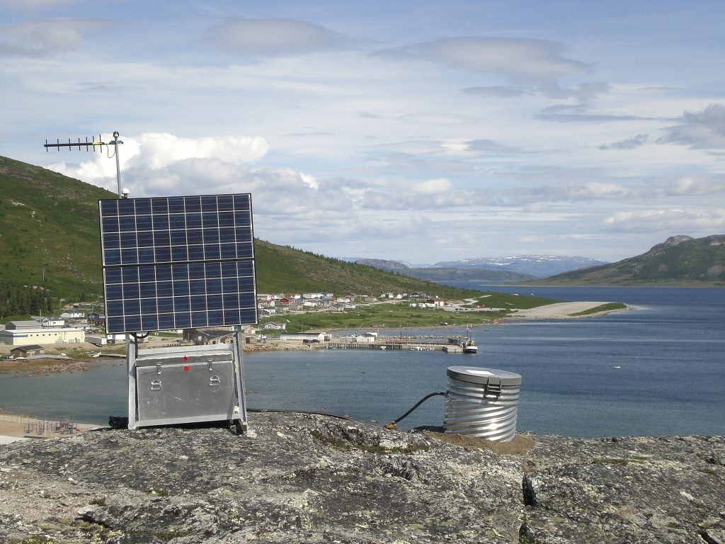
Seismograph station installed by Dr Darbyshire’s team in Nain, Canada, in 2011.
Past and Present Collide
One of the key questions facing Dr Darbyshire and her colleagues is in understanding the formation of the continents we see today. ‘There is still a great deal of debate regarding the formation and evolution of continental lithosphere,’ says Dr Darbyshire. ‘One of the biggest questions is whether “modern-style” plate tectonic processes have always existed on Earth and, if not, when did plate tectonics begin?’
By using the data collected by their seismograph stations, Dr Darbyshire and her team have been revealing insights into how the continents formed in the distant past. Specifically, their research aims to provide a better understanding of the geological history of the North American continent.
The North American continent is of special interest to geologists as some of its geological formations have been around for almost 4 billion years. As Earth is estimated to be approximately 4.5 billion years old, this means that these features must have formed very early on in the planet’s history. Such geological features therefore presented an incredible opportunity for Dr Darbyshire and her team to investigate the processes that drove the current arrangement of Earth’s continents, and how modern-day tectonic behaviour differs from its ancient form.
Features under the Appalachian Mountains in the north-eastern USA formed during our current geological eon, known as the Phanerozoic eon, which began around 538 million years ago. Nearby, the Laurentides territory of Québec hosts the Grenville Orogen, where landmasses collided and uplifted to form mountains about 1 billion years ago.
Further to the north under north-eastern Québec and Labrador, there is a series of cratons. These stable sections of the lithosphere formed in the Archean eon over 3 billion years ago, and are often found in the interiors of today’s continental plates. As they have survived for billions of years, despite being subjected to movement and collisions, they provide a snapshot of the very distant past.
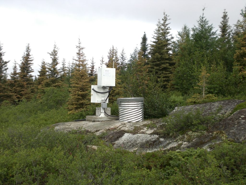
Seismograph station installed by Dr Darbyshire’s team in Kujjuarapik, Canada, in 2011.
These geological features have provided multiple new discoveries for Dr Darbyshire and her colleagues. For instance, Archean cratons found in the Churchill and Superior geological provinces in Canada are much more similar in composition and structure to each other than previously realised. Dr Darbyshire realised that any variations in the structures of these ancient continental cores were instead caused by tectonic events long after their formation.
‘We have shown that cratons are much more heterogeneous than previously realised, and the systematics in their variations can, in many cases, be correlated to their long-term tectonic evolution,’ says Dr Darbyshire.
Additionally, Dr Darbyshire and her team have gathered important data on the Trans-Hudson and Grenville Orogens, which formed vast mountain ranges between one and two billion years ago. As mentioned, orogens are regions where tectonic plates collide and uplift.
Interestingly, the ancient Trans-Hudson and Grenville Orogens bear a striking resemblance to the orogen that formed – and continues to form – the Himalayas. The researchers revealed very similar patterns of crustal thickness and composition between these ancient and active orogens. The similarities between the Himalayan-Karakoram-Tibetan Orogen and the Trans-Hudson and Grenville Orogens suggest that plate tectonic processes are the same across the world, and have also remained relatively unchanged for the last two billion years.
‘[This work provides] fundamental new constraints that contribute to the view that both orogens were similar in scale and nature to the present-day Himalayan-Karakoram-Tibetan Orogen and that modern-style plate tectonics was already in operation on the Earth by the early Proterozoic,’ explains Dr Darbyshire.
Her team’s research has greatly advanced our understanding of Earth’s lithosphere, particularly in regions that had not previously been studied in detail. ‘We are starting to understand more about the long and complex history of how the North American continent was built, and how it has evolved over a time period spanning about three-quarters of the Earth’s history,’ concludes Dr Darbyshire.
SHARE
DOWNLOAD E-BOOK
REFERENCE
https://doi.org/10.33548/SCIENTIA856
MEET THE RESEARCHER
Dr Fiona Darbyshire
Sciences de la Terre et de l’atmosphère
Université du Québec à Montréal
Montréal, Québec
Canada
Dr Fiona Darbyshire achieved her PhD at Cambridge University in 2000, for a project investigating the Earth’s crust in Iceland. Currently she is a full-time Professor at the Université du Québec à Montréal, and also holds an adjunct professorship at the University of Manitoba. Dr Darbyshire’s research has provided deep insights into Earth’s interior, and its evolution over the last three billion years. Over the course of her career, she has been granted with many honours, including being recognised with the Canada Research Chair title and a Canadian Geophysical Union Meritorious Service Award. Dr Darbyshire was also made an Ambassadeur for her work in organising the 27th IUGG General Assembly at the Palais des Congrès de Montréal.
CONTACT
E: darbyshire.fiona_ann@uqam.ca
W: https://www.geotop.ca/fr/membres/reguliers/F_Darbyshire
KEY COLLABORATORS
Andrew Frederiksen – University of Manitoba, Canada
Andrew Schaeffer, Riddhi Dave – Natural Resources Canada
Ian Bastow – Imperial College London, UK
Vadim Levin – Rutgers University, USA
Bill Menke – Lamont-Doherty Earth Observatory, USA
Suzan van der Lee, Seth Stein, Donna Jurdy – Northwestern University, USA
Douglas Wiens, Michael Wysession – Washington University at St. Louis, USA
Justin Revenaugh – University of Minnesota, USA
Randell Stephenson – University of Aberdeen, UK
Juan Carlos Afonso – Macquarie University, Australia & University of Twente, Netherlands
Trine Dahl-Jensen, Tine Larsen, Peter Voss – Geological Survey of Denmark and Greenland
Khaled Ali, Andrew Macdonald – De Beers
FUNDING
Natural Sciences and Engineering Research Council of Canada (NSERC)
Fonds de Recherche du Québec – Nature et technologies (FRQNT)
Canada Foundation for Innovation (CFI)
Natural Resources Canada GEM GeoNorth programme
De Beers Canada
US National Science Foundation
FURTHER READING
F Vervaet, F Darbyshire, Crustal structure around the margins of the eastern Superior craton, Canada, from receiver function analysis; Precambrian Research, 2022, 368, 106506.
O Bagherpur Mojaver, F Darbyshire, Crustal Structure Beneath the Northern Appalachians and the
Eastern Grenville Province, JGR Solid Earth, 2021, 127, e2021JB023246.
FA Darbyshire, ID Bastow, L Petrescu, A Gilligan, DA Thompson, A tale of two orogens: Crustal processes in the Proterozoic Trans-Hudson and Grenville Orogens, eastern Canada, Tectonics, 2017, 36, 1633-1659.
L Petrescu, ID Bastow, FA Darbyshire, A Gilligan, T Bodin, W Menke, and V Levin, Three billion years of crustal evolution in eastern Canada: Constraints from receiver functions, JGR Solid Earth, 2016, 121, 788-811.
![]()
![]()
REPUBLISH OUR ARTICLES
We encourage all formats of sharing and republishing of our articles. Whether you want to host on your website, publication or blog, we welcome this. Find out more
Creative Commons Licence (CC BY 4.0)
This work is licensed under a Creative Commons Attribution 4.0 International License. 
What does this mean?
Share: You can copy and redistribute the material in any medium or format
Adapt: You can change, and build upon the material for any purpose, even commercially.
Credit: You must give appropriate credit, provide a link to the license, and indicate if changes were made.
SUBSCRIBE NOW
Follow Us
MORE ARTICLES YOU MAY LIKE
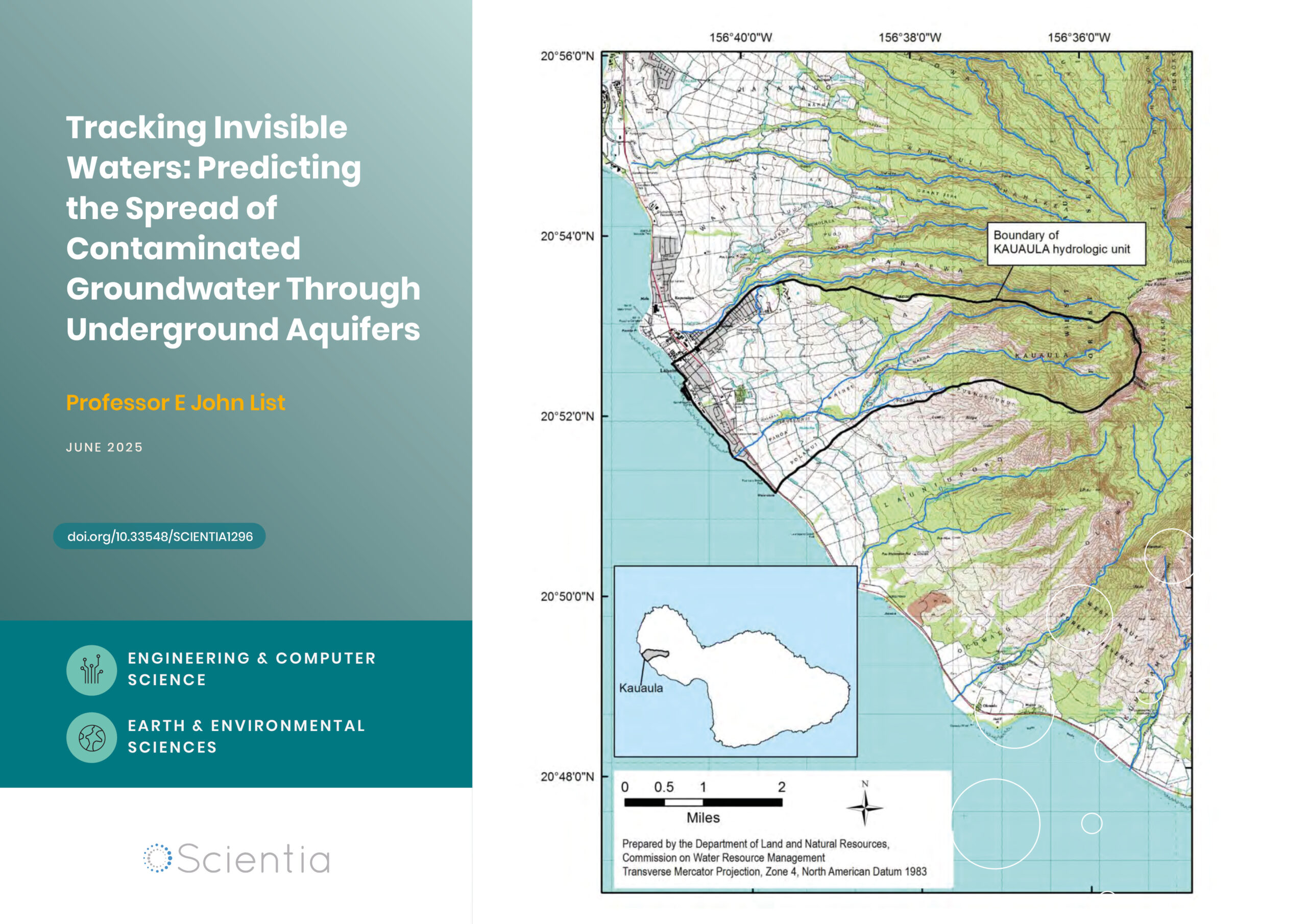
Professor E John List | Tracking Invisible Waters: Predicting the Spread of Contaminated Groundwater Through Underground Aquifers
When we think about water pollution, we often picture oil spills on the ocean surface or chemicals flowing down rivers. But some of the most significant environmental challenges occur completely out of sight, deep underground, where contaminated water moves through layers of rock and soil. Understanding how these invisible pollutants travel has profound implications for protecting our drinking water supplies and coastal ecosystems. Groundwater engineer Dr E. John List has developed an approach that challenges fundamental assumptions about how contamination spreads underground.

Dr Richard Marchant | Restoring the Flow: Stream Life Slowly Returns After Rabbit Eradication on Macquarie Island
The remote streams of subantarctic Macquarie Island are home to low diversity freshwater invertebrate communities with an unusual taxonomic composition. However, over a century of grazing by introduced rabbits dramatically degraded surrounding vegetation, increasing erosion and disturbing stream ecosystems. Following rabbit eradication in 2016, Dr Richard Marchant of Museums Victoria and colleagues from the University of Canberra and the Australian Antarctic Division investigated whether the island’s streams were recovering ecologically. Their study reveals a slow but measurable resurgence of invertebrate taxa, particularly in areas with moderate prior damage and vegetation regrowth, though full recovery remains uncertain.

Rediscovering Alfred Russel Wallace: The True Location of His Ternate Residence
In February of 1858, naturalist and explorer Alfred Russel Wallace, whilst in the village of Dodinga at Halmahera Island, Indonesia, independently outlined his theory of evolution through natural selection.
Wallace then returned to his rented home on the small island of Ternate, and sent his manuscript —now known as “The Ternate Letter”— to Charles Darwin.
For nearly 80 years Wallace’s rented house has been a subject of debate, with two houses contending as candidates albeit, as this paper confirms, neither being valid. The paper written by Paul Whincup describes how a combination of new research, fieldwork, and local insight has finally pinpointed the true site of Wallace’s House at Ternate.
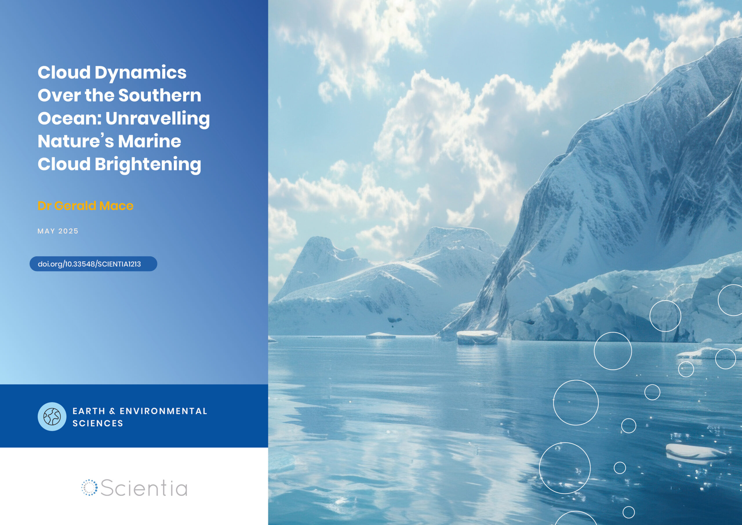
Dr Gerald Mace | Cloud Dynamics Over the Southern Ocean: Unravelling Nature’s Marine Cloud Brightening
In the pristine waters of the Southern Ocean surrounding Antarctica, scientists have discovered fascinating patterns in cloud formation that could have major implications for understanding Earth’s climate. Recent research conducted by Dr Gerald Mace from the University of Utah and colleagues reveals how air masses passing over the Antarctic continent naturally boost cloud brightness through a complex chain of chemical and physical processes. This natural phenomenon may hold important clues for improving climate models and predicting future climate change.