
Progeny: Developing Safeguards Against GPS Outages
Global Navigation Satellite Systems such as GPS are the backbone of many global communications, but they are not immune to failure. Progeny Systems Corporation is dedicated to mitigating such disasters if and when satellite-based communications fail, by developing Earth-based systems that work in comparable ways to synchronised satellite networks. As an alternative to GPS, the company’s technology could provide communicating parties with a crucial yet inexpensive safeguard against future failures.
Global Navigation Satellite Systems
In today’s technological landscape, our society is now more connected than at any point in history. Many of the infrastructures we have come to depend on are themselves dependent on almost instant communications between devices, which are often part of networks spanning many continents. Such vast, intricate networks are made possible by Global Navigation Satellite Systems (GNSSs) – groups of satellites orbiting far above the Earth, which are in constant communication with each other and devices on Earth.
‘The GNSS service is adopted worldwide, and its use within a wide range of technology is ubiquitous,’ explains John MacKay, a Chief Engineer at Progeny Systems Corporation. ‘Not a single cell phone or cell tower, power station, auto and marine navigation, or reference clock operates without some traceable tie to a GNSS constellation.’
The key to the success of this technology is the atomic clocks built into each satellite, which keep time to incredibly high degrees of accuracy. This allows the GPS receivers to perform a technique named ‘trilateration’, which involves measuring the time taken for light-speed signals to travel from the satellites to the receivers. Receivers, including cell phones, know the predicted location of each satellite by downloading a file called the ‘ephemeris’ during the process of receiving the GPS data. From the trilateration measurements, and the known position of all satellites at the time of the measurement, the receivers can continually calculate their positions relative to the satellites and can map this location on the Earth.
‘In addition to providing location, the service performs time transfer, whereby any local, low-cost clock can receive time from the service, synchronise to it, and achieve accuracy that is on par with the best clocks in the world,’ MacKay continues. ‘This enables time accuracy on cell phones to be substantially better than a second.’ Most of the time, GNSS systems work so flawlessly that most of us forget that they are even there. However, this stability cannot always be guaranteed.

A Fragile Dependence
Despite their enormous capabilities, GNSS systems are not invincible. For reasons ranging from technological failure to attacks by malicious groups, these systems can fail, and indeed have done so in the past. ‘For the world’s dependence upon this service, its fragility is deeply troubling,’ says MacKay. ‘The more amazing aspect of the GNSS than its utility is the impact of its loss. In July 2019, for example, the European GNSS service, Galileo, suffered a signal outage. If this occurred in the US’s GNSS system, GPS, the costs incurred by navigation errors and delayed shipments could be upwards of $1 billion per day.’
One of the biggest problems with these systems stems from one of their main advantages: due to their pinpoint instrumental accuracy, they can communicate with each other using extremely weak signals. In addition, GNSS systems are so easy to use that it is relatively simple for anyone on Earth to find out how they operate, the frequencies at which they transmit their signals, and calculate their exact positions, leaving them vulnerable to attack.
‘There are several ways that GNSS can be compromised, some of which are malicious,’ explains MacKay. ‘The task is relatively simple to perform; the GNSS signals are extremely low power, and the transmission frequencies well known.’ As globalised infrastructures rely more and more on the accuracy of these position and time measurements, the stakes of failure of GNSS systems are now becoming increasingly apparent. This creates a critical need for users of communications systems to access reliable backup systems, if and when GNSS satellites fail.
‘We are trying to allow ordinary radios to do the same thing as GPS does. Our goal is to make communication systems used in everyday life that perform with a knowledge of time. When we know the precise time that events occur, we can use this information to relate events that are at great distances, and do it much more simply.’

Developing a Backup System
To implement these backup systems, the Progeny team, which also includes Senior Electrical Engineer Gregory Hall, and Senior Engineering Manager Ron Murdock, aims to construct infrastructures on Earth that are comparable to those of GNSS systems. ‘In this project, we are trying to allow ordinary radios to do the same thing GPS does,’ MacKay explains. ‘Our goal is to make communication systems used in everyday life that perform with a knowledge of time. When we know the precise time that events occur, we can use this information to relate events that are at great distances, and do it much more simply.’
To do this, Progeny is developing radio hardware that can communicate with nearby radio ‘anchors’ instead of satellites. Including structures such as radio towers, these anchors allow for a bi-directional flow of information. This means that they not only transmit signals, but they can also receive information from distant devices, which can include further instructions about what to transmit. Furthermore, these anchors may themselves be in contact with timekeeping ‘master’ towers with their own atomic clocks, allowing each anchor to keep its own highly accurate time.
Within these existing infrastructures, Progeny’s mobile radio device can send out a signal to an anchor, asking it to transmit information detailing its position. In addition, the precise time kept by the anchor will allow it to tell how far away it is from the device. If a device is within range of at least three of these synchronised anchors, therefore, trilateration can be used to calculate its exact position, with undiminished accuracy compared with GPS.
‘If GPS is not available, we can provide the same position service with common, low-cost radios, such as cell phones and Wi-Fi hotspots,’ continues MacKay. ‘At a program level, we are making systems that can take this timing information from any radio, and combine it, so that we can take advantage of any transmission, especially if some are better than others, based on location.’ In this system, therefore, the tasks of all components of a GNSS system are carried out by Earth-based counterparts, at very little cost to the user.

Attainable Alternatives to GPS
In their research, MacKay, Hall, Murdock and their colleagues at Progeny have now successfully demonstrated a reliable, Earth-based alternative to GPS in two different ways. ‘First, we made radio hardware used for industrial, scientific, and medical data links become “time aware”, so that we include the time that data is sent or received in the data stream,’ describes MacKay. This insight revealed that devices in practical communications systems can indeed remain in sync with each other during their operations.
In addition, the company’s researchers have shown that two radio devices in contact with each other can be made to synchronise their readings for position and time, with undiminished accuracy compared with GPS. ‘We worked with a commercial vendor that makes radios to include our “time aware” function in their radios, so that a rugged commercial handheld two-way radio became “time aware”,’ MacKay continues. ‘We tested this radio in a realistic scenario – a plane on one side of the link and a person on the ground on the other, and showed that we operated the same as a GPS radio, with the same position accuracy.’
Achieving these capabilities with such simple technology now represents a significant step towards reliable backup communications systems. Crucially, the hardware would be attainable for virtually any communicating party at very little cost – ultimately ensuring that GNSS outages will become far less of a setback to society as a whole.
Safeguarding Against Future Outages
The Progeny team believes that their technology could become a vital component of many communications systems in the future, for ensuring that their operations don’t shut down during GNSS failures. ‘This system has universal use, particularly in civil applications,’ MacKay explains. ‘Critical infrastructure affected by the Galileo outage can be maintained by a mesh of radio links that are time-aware, and transfer time from a known good source. Just as important, it can be deployed quickly, so for emergent outages it can prevent loss of the services needed for infrastructure. It can be suspended just as quickly when normal service is restored. Universal adoption of the technology into cell phones and wifi networks could provide a reliable backup or replacement for GPS.’
Furthermore, the technology developed by the Progeny team could provide a useful basis for communications in built-up areas, where GNSSs can struggle to keep in contact with many closely packed devices at the same time. Since radio communications can take place across many different channels, each with its own unique frequency, this problem could be minimised. ‘GPS gets confused in cities due to the signal being blocked by skyscrapers, but Wi-Fi and cell phone signals are usually reliable,’ says MacKay.
By implementing such reliable communications systems with a device as common and simple as a radio, virtually any communicating party on Earth can continue its operations as normal during an outage. As the world becomes increasingly connected, the damage that could be unleashed during attacks and outages will only increase. However, Progeny’s hardware will ensure that the intricate connections that keep society ticking can remain in place, even during prolonged failures of satellite networks.
Reference
https://doi.org/10.33548/SCIENTIA437
Meet the researchers
John MacKay
Progeny Systems Corporation
Charleroi, PA
USA
John MacKay has a BSEE degree from the University of Rochester and over 32 years of engineering experience, with a focus on system engineering of hardware intensive systems. He has extensive experience leading multi-disciplinary teams to design, produce, integrate and manufacture complex hardware and software-intensive electronic, sensor and weapon systems. Mackay has also devoted significant effort in the development and advancement of precision time transfer, and its use as a solution for real-world challenges.
CONTACT
Gregory Hall
Progeny Systems Corporation
Charleroi, PA
USA
Gregory Hall graduated with a BS in Electrical Engineering from Pennsylvania State University in 1998. He also graduated with honours in Electrical and Computer Engineering from Johns Hopkins University in 2007. His work at Progeny Systems includes the primary radio-frequency and hardware engineering involved with NASA’s ‘Lunar Surface Navigation Precision Time Protocol Based Trilateration for Planetary Navigation’. In addition, Hall has been the principle investigator for two projects aiming to further develop scalable Ka/Ku band antenna for aerospace applications.
CONTACT
Ron Murdock
Progeny Systems Corporation
Middletown, RI
USA
Ron Murdock has a BSEE degree from the University of Vermont and a 37-year background in the development, testing and evaluation of complex tactical systems, particularly submarine combat systems. Currently, he is a senior engineering manager at Progeny Systems Corporation, where he has been employed since 1998. His technical leadership roles have included systems engineering for advanced submarine control, tactical sonars, sonar signal processing, torpedo countermeasure design, embedded digital data collection systems, sensor manufacturing, acoustic testing and navigation in GPS denied environments.
CONTACT
COMPANY WEBSITE:
https://www.progeny.net/
FUNDING
IRAD
NASA
NAVAIR
USAF
Office of Naval Research

Creative Commons Licence
(CC BY 4.0)
This work is licensed under a Creative Commons Attribution 4.0 International License. 
What does this mean?
Share: You can copy and redistribute the material in any medium or format
Adapt: You can change, and build upon the material for any purpose, even commercially.
Credit: You must give appropriate credit, provide a link to the license, and indicate if changes were made.
More articles you may like

Dr Rhett Martin | Governing Nature at the Edge of Collapse
For millions of men, ageing brings with it a set of frustrating and often disruptive urinary symptoms. These symptoms, caused by benign prostatic hyperplasia, or BPH, can affect sleep, confidence, and overall quality of life. Traditionally, treatment follows a familiar path. Patients begin with medications, often for years, and may eventually progress to surgery if symptoms worsen. Yet this pathway is not without its drawbacks. Medications can cause side effects, while surgery carries risks and recovery time. In recent years, a minimally invasive interventional radiology procedure called prostate artery embolisation, or PAE, has begun to challenge this traditional model. At the forefront of this shift is a collaborative research group, led by Dr. Nicholas Brown of the University of Queensland, whose series of P-EASY studies has explored whether PAE could transform how BPH is treated, particularly at earlier stages.

Assoc Prof. Nicholas Brown | Rethinking Prostate Care: A New Frontier in Treating Benign Prostatic Hyperplasia
For millions of men, ageing brings with it a set of frustrating and often disruptive urinary symptoms. These symptoms, caused by benign prostatic hyperplasia, or BPH, can affect sleep, confidence, and overall quality of life. Traditionally, treatment follows a familiar path. Patients begin with medications, often for years, and may eventually progress to surgery if symptoms worsen. Yet this pathway is not without its drawbacks. Medications can cause side effects, while surgery carries risks and recovery time. In recent years, a minimally invasive interventional radiology procedure called prostate artery embolisation, or PAE, has begun to challenge this traditional model. At the forefront of this shift is a collaborative research group, led by Dr. Nicholas Brown of the University of Queensland, whose series of P-EASY studies has explored whether PAE could transform how BPH is treated, particularly at earlier stages.

Jean Lycke | Addressing Unmet Medical Needs in Mucosal Disease: A Close-to-Market Innovation Approach
Recurrent Aphthous Stomatitis (RAS) is an oral condition characterized by one or several painful mucosal ulcers. RAS affects a large proportion of the population and has a point prevalence of approximately 2–3%, daily. The etiology remains unknown, and there is currently no curative treatment. Most patients experience recurring episodes over time, with each episode typically lasting up to a week. Here, we describe the development of a mucoadhesive patch which, when applied over a RAS ulcer, provides rapid pain relief. The patch is easy for patients to apply when symptoms begin and has the potential to be used as an over-the-counter product. The development of the Mucocort mucoadhesive patch is an example of a Close-to-Market innovation strategy that embraces simplicity within a complex healthcare system. By simplifying the product concept, the team has reduced the number of regulatory steps required before market approval. This MedTech/Pharma innovation model, known as the “4R” framework – Re-purposing, Re-formulation, Re-positioning, and Re-patenting – has guided the program from concept to commercialization. In addition to the biodegradable mucoadhesive patch developed for RAS ulcers, the team is extending the innovation concept to a mucoadhesive gel formulation for the prevention and treatment of chemotherapy-induced mucositis. This gel-based program is being commercialized separately through MucoShield.
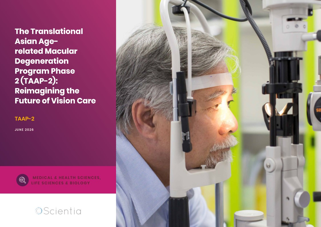
The Translational Asian Agerelated Macular Degeneration Program Phase 2 (TAAP-2): Reimagining the Future of Vision Care
Age-related macular degeneration, often abbreviated as AMD, is one of the leading causes of vision loss among older adults worldwide. In Asia, where populations are ageing rapidly, its impact is particularly profound. For many, the disease quietly erodes central vision, making everyday activities such as reading, driving, and recognising faces increasingly difficult. Against this backdrop, the Translational Asian Age-related Macular Degeneration Programme, or TAAP for short, has emerged as a bold and ambitious effort to confront the disease headon. Now in its second phase, TAAP-2 represents a significant evolution in both scientific scope and clinical ambition.