
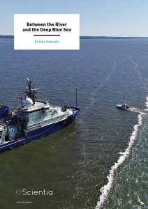
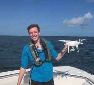
Dr Alex Simpson | Between the River and the Deep Blue Sea
Despite living on a very watery planet, there is a lot we do not understand about rivers, seas and oceans. One particular zone of interest, the place where rivers and oceans meet, remains mysterious to scientists. Dr Alex Simpson, from Scripps Institution of Oceanography, University of California San Diego, has worked with a team of scientists to look more closely into the dynamics of what happens to fresh river water when it reaches the salty ocean, and how this can affect river estuaries and nearby coastal areas.
A Drop in the Ocean
When the freshwater flowing down a river reaches the coast, it will inevitably be released into a sea or ocean, both of which are saline (meaning salty). However, this interaction between fresh water and saline water is not as simple as it might first seem. We might readily assume that the fresh river water just disperses into the salty ocean and becomes part of the ocean but there is a lot more to the story.
The output of water where a river meets the sea (otherwise known as the river plume) is an important area of interaction between the land and the sea, and to understand how our land-based activities affect seas and oceans, it is crucial that these areas are studied.
There are several reasons for this. To start, fresh river water is rarely as clean and pristine as we would like it to be. Due to industry and agriculture, many rivers are now heavily polluted with chemicals, which, on reaching the ocean can negatively affect ocean wildlife. Rivers also carry physical pollutants such as plastics, which again are released straight into seas and oceans, causing potential devastation to ocean-dwelling organisms.
River estuaries are by their very nature changeable, and they act as important living and breeding habitats for many marine species. The size and dynamics of river plumes vary according to the physical geography of the river estuary and seabed, the speed and volume of the river and the overall environment. Sometimes, the freshwater stays on the top layer of the sea, and can spread out far and wide before dispersing into the sea. Other river plumes see the freshwater taking up the whole depth of the sea they are flowing into, and thus will have a very different set of features.
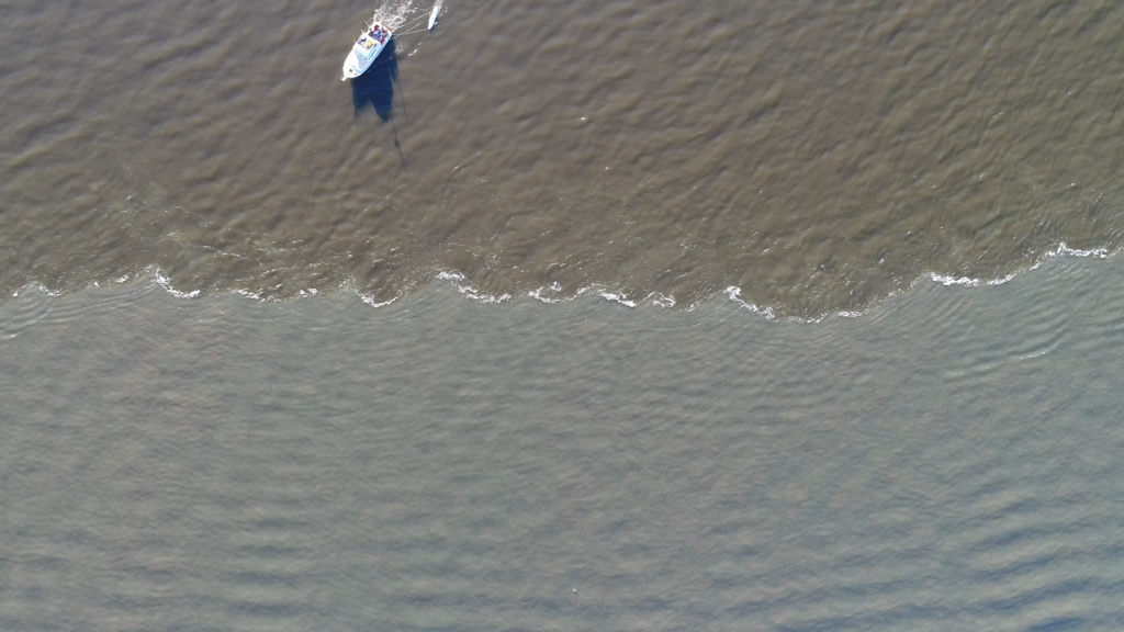
Credit: Alex Simpson
Watching the Sea Change
Along with a team of coastal researchers, Dr Alex Simpson from Scripps Institution of Oceanography, University of California San Diego, set about measuring and recording the complex interactions between river and ocean. The area they chose to study was where the Connecticut River and the salty water of Long Island Sound meet each other, in Connecticut, USA. Technically, the water in Long Island Sound is brackish, which means that it is less salty than the sea but more salty than fresh water. This area of water happens to have a particularly clear boundary, or ‘front’, where the river water and the salty water meet, leading the team to choose it as an ideal place to study.
The nature of the environment at the river estuary means that there are a lot of data to consider. The amount of water running down (or flow of) the river, the ebb and flow of the tide in the sea, and the wind; all of these factors affect the state of play at any one time, making this a particularly complex task. What happens under the water will also affect what can be observed on the surface.
The team was already aware that during ebb tides, as the sea moves back away from the coast, the boundaries between saltwater and freshwater river plumes often produce features which are called ‘lobe and cleft instabilities’, which have been observed in many previous studies. These look like waves, which are formed due to the complex dynamics of the two types of fluid, saltwater and freshwater. Dr Simpson’s team wanted to find out more about the causes of these features, along with their size and how long they last. Once the dynamics are understood in greater detail, it is then possible to create models, which help scientists to predict what will happen in other scenarios.
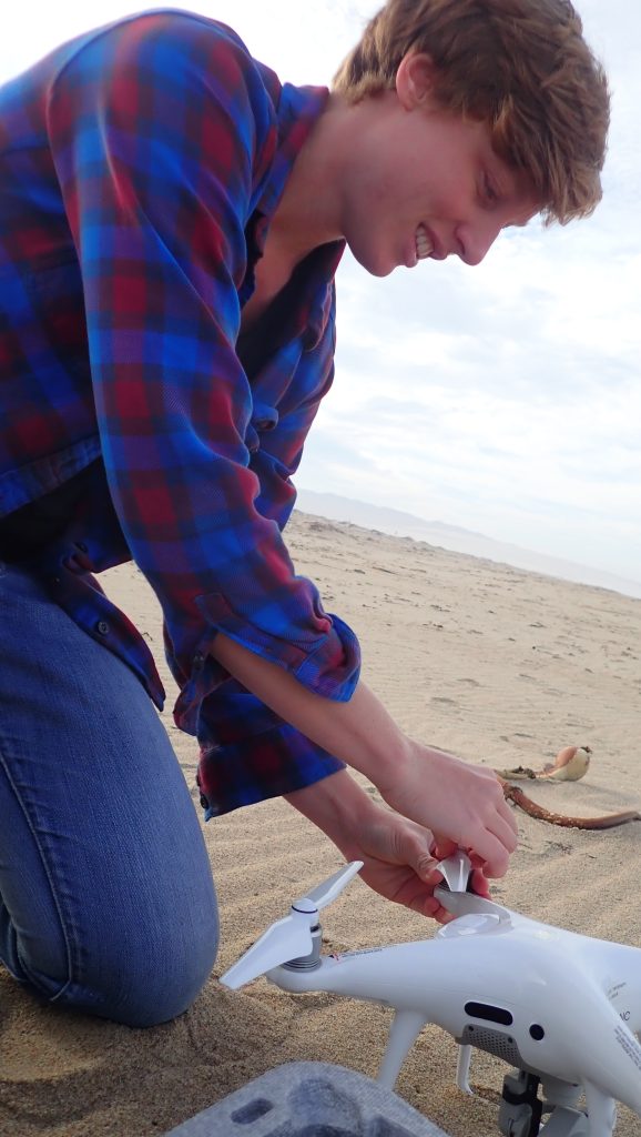
Dr Simpson and her team were keen to use remote sensing techniques, which include aerial cameras, marine radar, and satellite imagery to study this area of water, alongside measurements taken in situ, from boats on the water. This allowed them to build up a very detailed picture of the interaction between the salty and the fresh water in this area.
The first part of the study saw the team launching a drone with a video camera to collect high-quality video of the front where the salty water and the freshwater meet. The team were then able to analyse frames of the videos they had obtained, to precisely measure the size of the surface features. They also measured the speed at which the wave-like features propagated formed. This was tricky, as they had to make sure that they were not measuring the actual waves which naturally form on the surface of the sea. These waves are nothing to do with the features that form due to the interaction between the freshwater and the seawater but can look very similar.
The team also used drone footage to estimate the direction and speed of the surface currents of both bodies of water, and as such, to build up a more complete picture of the forces involved in the area of the river plume front.
Credit: Jenessa Duncombe
Rocking the Boat
The second part of the data collection undertaken by Dr Simpson and the team utilised a boat with a variety of sensing equipment so that they could cross the boundary between the waters. The purpose of this was to detect factors such as the speed the water was moving at different depths and the salinity of the water at several points. The boat crossed the front several times, going back and forth in both directions, to collect as much data as possible.
The data gained from the instruments on the boat enabled Dr Simpson and her team to build up a three-dimensional model of the complex boundary between river and sea, as they took their venture back to shore and started the work of analysing all the data they had.
On the Right Track
In the last part of the research project, Dr Simpson and the team used numerical modelling to shed more light on the features observed in the Connecticut River plume. This was partly to see if they could replicate (on a computer) the conditions they had detected in the water. If the computer model worked, this would help them predict the likelihood of the surface features occurring in any particular set of circumstances.
The team found that when they created a computer model of the water conditions in Long Island Sound, the computer predicted conditions and features which were broadly similar to those the team had observed during part one of the project. Understanding the complex dynamics of these unique areas of water is important, as river estuaries are the places where the land and the sea interact, and can therefore affect each other the most.
Credit: Erik Jepsen
Making Waves
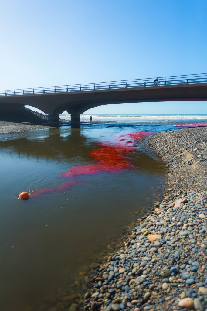
More recently, Dr Simpson has been taking part in another experiment with a team at Scripps Institution of Oceanography. This unique experiment involves dyeing water from a small river pink, so that it can be traced and recorded as it releases into the ocean. Their rationale is that due to the small size of the river, the waves coming towards the shore from the sea might actually stop the river water from dispersing into the sea, and could force the fresh water to run along the coast on one or both sides of the river estuary.
This could prove to be important in unfortunate cases such as the river getting polluted, as it would give environmentalists insight into where the pollution might end up, meaning they can respond more effectively and also warn people of any danger. It is also important in adding to our understanding of how smaller rivers interact with the oceans, since focus is usually directed towards larger, more attention-grabbing river estuaries.
This is one of the first studies looking at the area where the sea, river, surf and coast all meet, and is an excellent example of joined-up thinking. Such approaches are needed now more than ever if we are to solve the self-imposed environmental problems we now face. The project is still ongoing, but ultimately, will aid our understanding of the fate of freshwater and land-derived materials as the plumes enter the coastal ocean and the surf zone.
The Coast is Clear
As our planet becomes increasingly destabilised by factors such as global heating and the huge changes we have caused, as a species, it is vital that scientists such as Dr Simpson continue their work to better understand how it all works. As the oceans warm up, and polar ice caps continue to melt, causing sea levels to rise, we will most likely see an increasingly large effect on our shorelines. Knowledge of the complex interactions such as those at river plumes will be critical as we work to confront the ongoing effects of our actions on planet Earth.
SHARE
DOWNLOAD E-BOOK
REFERENCE
https://doi.org/10.33548/SCIENTIA982
MEET THE RESEARCHER
Dr Alex Simpson
Scripps Institution of Oceanography
University of California San Diego
La Jolla, CA
USA
In 2021, Dr Alex Simpson obtained her PhD in Civil and Construction Engineering at Oregon State University. She had previously gained an undergraduate degree in Engineering from Cornell University in 2013 and also a Master’s degree in Civil and Construction Engineering in 2016 from Oregon State University. Dr Simpson is currently a postdoctoral researcher at Scripps Institution of Oceanography, University of California San Diego. In her role as a coastal physical oceanographer, she is particularly interested in remote sensing-based observational techniques alongside in-situ observations to discover more about the ocean. Dr Simpson is also committed to scientific outreach, most recently having served on the organising committee for the Young Coastal Scientists and Engineers Conference held in 2019 and among other activities, has undertaken live interviews with popular news outlets in the USA.
CONTACT
W: giddingslab.ucsd.edu/staff-members/dr-alexandra-simpson
KEY COLLABORATORS
- Fengyan Shi, Center for Applied Coastal Research, University of Delaware, USA
- Joseph T. Jurisa, Horn Point Laboratory, University of Maryland Center for Environmental Science, Cambridge, USA
- David A. Honegger, School of Civil and Construction Engineering, Oregon State University, USA
- Tian-Jian Hsu, Center for Applied Coastal Research, University of Delaware, Newark, USA
- Merrick C. Haller, School of Civil and Construction Engineering, Oregon State University, USA
FUNDING
Office of Naval Research
FURTHER READING
AJ Simpson, F Shi, JT Jurisa, et al., Observations and modelling of a buoyant plume exiting into a tidal cross-flow and exhibiting along-front instabilities, Journal of Geophysical Research: Oceans, 2022, 127, e2021JC017799. DOI: https://doi.org/10.1029/2021JC017799
REPUBLISH OUR ARTICLES
We encourage all formats of sharing and republishing of our articles. Whether you want to host on your website, publication or blog, we welcome this. Find out more
Creative Commons Licence (CC BY 4.0)
This work is licensed under a Creative Commons Attribution 4.0 International License. 
What does this mean?
Share: You can copy and redistribute the material in any medium or format
Adapt: You can change, and build upon the material for any purpose, even commercially.
Credit: You must give appropriate credit, provide a link to the license, and indicate if changes were made.
SUBSCRIBE NOW
Follow Us
MORE ARTICLES YOU MAY LIKE
Dr Rhett Martin | Governing Nature at the Edge of Collapse
For millions of men, ageing brings with it a set of frustrating and often disruptive urinary symptoms. These symptoms, caused by benign prostatic hyperplasia, or BPH, can affect sleep, confidence, and overall quality of life. Traditionally, treatment follows a familiar path. Patients begin with medications, often for years, and may eventually progress to surgery if symptoms worsen. Yet this pathway is not without its drawbacks. Medications can cause side effects, while surgery carries risks and recovery time. In recent years, a minimally invasive interventional radiology procedure called prostate artery embolisation, or PAE, has begun to challenge this traditional model. At the forefront of this shift is a collaborative research group, led by Dr. Nicholas Brown of the University of Queensland, whose series of P-EASY studies has explored whether PAE could transform how BPH is treated, particularly at earlier stages.

Nick Martin | Data Assimilation: Overcoming AI’s Data Uncertainty Limitations for Water Resources
Water resources are essential for human life. Knowing how to manage water, both now and in the future, is necessary to continue using it as well as possible. Nick Martin and Jeremy White are examining limitations to artificial intelligence applications in water resources generated from noisy and estimated data sets. For poor quality data sets, they found that machine learning models will perform poorly relative to tools that explicitly include physics-based descriptions of physical processes; this is because physics-based calculations can use both data and physics knowledge through data assimilation techniques.

Nick Martin | The Future of Floods: Smarter Risk Tools for Sustainable Water Management in a Changing Climate
Sustainable decision-making requires balancing the costs borne by today’s society with those that will fall on future generations. Climate change is intensifying extreme weather, making floods more severe because a warmer atmosphere can hold and deliver a larger volume of water as precipitation. It may also be the case that severe floods are becoming more frequent as drought becomes more frequent, average conditions rarely occur, and weather oscillates between short duration wet and long duration dry extremes. Worryingly, traditional infrastructure (often designed using outdated, backward-looking models) risks failing under these evolving conditions.
Nick Martin from Vodanube LLC, and his colleagues have applied Probabilistic Risk Assessment (PRA) to flood inundation. Their research optimises current adaptation and future mitigation strategies, even while acknowledging PRA’s limitations. The team demonstrates how this approach can guide more resilient water resource management, and highlights opportunities for further study.
Dr James D. Burrington | Fuelling Hydrogen’s Role in a Net Zero Future
Hydrogen is often touted as the fuel of the future, but how much can it really contribute to global decarbonisation? Dr James D. Burrington, founder of NiceChemistry.com, has modelled how hydrogen technologies, particularly green hydrogen, might support worldwide net zero goals. His research applies rigorous metrics to assess energy efficiency, cost, emissions, and land use. This revealed that, while hydrogen may not directly replace electricity, it could be critical in decarbonising sectors where electrification falls short.