
Dr Xander Wang – Adapting to Climate Change Using Regional Models
As the impacts of climate change become increasingly obvious worldwide, focused efforts to mitigate its worst effects are becoming more urgent. Through his research, Dr Xander Wang at the University of Prince Edward Island aims to innovate the computer models used to predict these future changes on smaller, regional scales. His team’s work is making important strides towards an advanced predictive toolset, which policymakers could use to make the best possible decisions about how to protect local populations from future climate-related disasters.
Climate Change Mitigation and Adaptation
Over the next few decades, climatologists widely predict a global increase in extreme events, including droughts, storms, floods, and fires. While efforts to cut our greenhouse gas emissions are key to minimising the severity of these impacts, there will be no way for us to avoid them entirely. To protect vulnerable populations, particularly in the developing world, it will be crucial for carbon-cutting measures to be rolled out alongside robust methods to adapt to a warming climate – allowing populations to better cope with the changes to come.
Key to the success of these efforts are global climate models. Global climate models are computer simulations that use complex calculations to predict the likely global impacts of climate change, and how they will vary between different regions. However, this approach faces some serious challenges. For one, it is far from certain how quickly greenhouse gas emissions will be reduced over the next few decades. In addition, depending on the calculations they use, and the factors they consider, climate models can produce widely varying outcomes.
‘The choices of greenhouse gas emissions scenarios and global climate models can lead to substantial uncertainties in the resulting climate projections. Furthermore, the limited resolutions of global climate models cannot determine spatial variations between regional climates, which are regulated by topography and land use,’ says Dr Xander Wang of the University of Prince Edward Island.
Dr Wang and his team aim to address these challenges through a more advanced understanding of the smaller-scale impacts of climate change. They do this through a combination of three overarching techniques: high-resolution climate modelling; statistical downscaling; and urban flood modelling.
Modelling Regional Climates
Although they can’t present an all-encompassing view of Earth’s global climate, regional models can be used to predict future climate patterns on scales of just tens of kilometres. To make these predictions, the models consider the influence of local-scale factors, including air motions, cloud formation, precipitation, and the radiation of heat. They have now been applied to numerous regions across the globe – allowing climatologists to predict the impacts of climate change on far more local scales.
Through his research, Dr Wang has developed new methods to account for inherent differences between the predictions made by different models, as well as the wide range of possible future emissions scenarios. ‘The approach can quantify the various uncertainties associated with future climate projections,’ he describes. ‘It provides probabilistic information for assessing the potential risks and costs associated with regional climatic changes.’
Today, Dr Wang’s methods have been used by thousands of researchers and engineers worldwide. Compared with greenhouse gases, they can provide far more practical guidance on the adaptation methods that will be needed on regional scales, in order to prepare for the worst potential consequences of climate change.
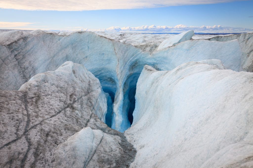
Stabilising the Greenland Ice Sheet
One region in which smaller-scale climate models have been particularly crucial is the Greenland ice sheet, which contains close to 3 million cubic kilometres of ice. This volume would raise global sea levels by over 7 metres if it were to melt entirely. If even just a fraction of this melting occurs within our lifetimes, it would still pose serious threats to low-lying coastal communities. From a climate change mitigation perspective, it is critical for researchers to determine whether the ice sheet could be stabilised under current carbon reduction goals, as set out in the 2015 Paris Agreement.
Using regional climate models, Dr Wang and his colleagues could closely predict this degree of melting, under various different emissions scenarios. In their simulations, which they validated by comparing their performances with historical data, they accounted for factors including cloud cover, snowfall, and temperature variations from daily to multi-year timescales.
The study revealed that if the average increase in global temperatures could be limited to 1°C within the next 30 years, any loss in Greenland’s ice coverage could be constrained to below 10% – allowing the ice sheet to remain stable well beyond the year 2050. In contrast, if no effective carbon reduction measures are taken right now, we would very likely lose this opportunity. The result highlights the urgency of mitigation measures which must be taken now, before it is too late.
Statistical Climate Downscaling
In order to make the most accurate possible predictions of future changes to Earth’s climate as a whole, it is important to incorporate both the high resolutions of regional climate models, and the far larger scope of global climate models. To do this, researchers in previous studies have developed a technique named ‘statistical downscaling’. This approach identifies quantitative relationships between large-scale variations in Earth’s atmosphere – named ‘predictors’ – and local-scale variables such as temperature and precipitation – named ‘predictands’.
Statistical downscaling is particularly desirable, as it can be implemented using far less computing power than other techniques. But according to Dr Wang, many previous uses of the technique have been based on an unproven assumption. ‘Most of the conventional statistical downscaling techniques assume that each climate predictand of interest depends on large-scale atmospheric predictors,’ he explains. ‘There is no guarantee that such a functional relationship exists in reality.’
To address this issue, Dr Wang and his colleagues have developed a method named ‘stepwise cluster analysis downscaling’ (SCADS). Using advanced statistical techniques, SCADS can describe more realistic relationships between predictors and predictands, in which changes to one may not necessarily produce a linear response in the other. SCADS has been converted into an R open-source package – rSCA, which is available at: https://cran.r-project.org/package=rSCA.
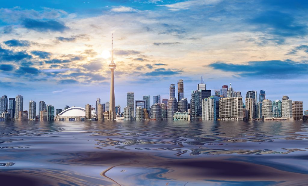
Predicting Changes in Ontario
Following its initial rollout in 2013, SCADS has now become incredibly popular among climatologists. ‘The method is widely used by other researchers around the world, for techniques including statistical climate downscaling, hydrological modelling, air pollution prediction, and image classification for remote sensing,’ Dr Wang illustrates.
In his own research, Dr Wang has used SCADS to study the Great Lakes region – the largest fresh water system on Earth, which strongly influences the regional climate of Canada’s Ontario province. Using global climate models, researchers would only be able to study this region at resolutions ranging from 150 to 300 kilometres – far from sufficient for capturing vital details in small-scale, regional climates. Using SCADS, the team could incorporate the predictions of regional climate models into global climate models – achieving resolutions as fine as 10 kilometres, across the whole expansive region.
From these studies, Dr Wang’s team predicted that both Ontario and the Great Lakes will experience a significant warming trend throughout the coming century: becoming roughly 6°C warmer by the 2080s – which is significantly higher than the projected rise in average global temperature. The models also predicted that this warming would be accompanied by a rapid increase in precipitation – potentially rising by around 12% by the 2050s, driven by an increase in the intensity of rainstorms. These results paint a clear picture of how climate change may disproportionately affect the local climates of specific regions. In the near future, they could provide crucial information for local policymakers, as they mitigate against the likely damaging consequences of these changes.
Modelling Urban Floods
Alongside future predictions of a warming climate, researchers also widely predict that the world’s population will become increasingly urbanised throughout the next century – resulting in many regions where millions of people are clustered within areas of just several square kilometres. If this is the case, even the predictions provided by regional models and statistical downscaling will not be enough to accurately predict the nature of the threats posed by small-scale climate changes.
For many climatologists, one of the most concerning threats to cities is an increase in flooding – caused by storm surges or intense rainfall. In urban environments, this water cannot readily drain away when much of the ground is covered in impermeable concrete and asphalt – allowing it to flow across the surface into other parts of the city. ‘Increasing city resilience to floods under climate change has become one of the major challenges for decision makers, urban planners, and engineering practitioners around the world,’ Dr Wang describes. ‘Accurate prediction of urban floods under heavy rainfall is critically important to address such a challenge.’
Dr Wang’s model incorporates high-resolution maps of elevation within cities, which capture the small-scale variations created by structures such as buildings and roads. These models are then divided into grid cells, from which water can flow into and out of adjacent cells at varying rates. This allows the researchers to simulate interactions between water flowing in and out of urban environments during heavy rainfall or storm surges, and then calculate the resulting water depth throughout the city.
Preparing for Future Changes
When used in combination with larger-scale climate predictions, provided by regional climate models and statistical downscaling, Dr Wang hopes that his flood modelling approach could help to reduce the human consequences of severe flooding events in the future. ‘The model can help understand the vulnerability of a city to future climate change, and simulate the effectiveness of various sustainable engineering techniques in reducing urban flooding risks in real urban settings,’ he says. ‘It is now being used by many researchers and city planners to assess urban flooding risks around the world.’
Altogether, through their three lines of research, Dr Wang and his colleagues are making important strides towards a robust modelling toolset, which allows climatologists to predict local changes to regional climates with an unprecedented degree of accuracy. Ultimately, Dr Wang hopes that these techniques will inspire focused and more urgent climate action, bridging the gap between symbolic declarations of a climate crisis, and meaningful action to protect human populations from its worst impacts.
SHARE
DOWNLOAD E-BOOK
LISTEN TO THE AUDIO
REFERENCE
https://doi.org/10.33548/SCIENTIA774
MEET THE RESEARCHER
Dr Xiuquan (Xander) Wang
School of Climate Change and Adaptation
University of Prince Edward Island
Charlottetown
Canada
Dr Xiuquan (Xander) Wang completed his PhD in Environmental Systems at the University of Regina in 2015, after which he worked as an Assistant Professor in the School of Geosciences at the University of Louisiana at Lafayette. He then joined the University of Prince Edward Island (UPEI) in 2018, where he became an Associate Professor in the School of Climate Change and Adaptation in 2021. Dr Wang is also a founding member of the world’s first multidisciplinary undergraduate program in Applied Climate Change and Adaptation at UPEI. He has also developed several well-known and widely-used software tools, aimed at supporting a global adaptation to climate change, including the Climate Change Data Portal, rSCA, and FloodMapper, which he continues to maintain.
CONTACT
E: xxwang@upei.ca
W: projects.upei.ca/xanderwang
FUNDING
Natural Sciences and Engineering Research Council of Canada
New Frontiers in Research Fund
Atlantic Canada Opportunities Agency
Agriculture and Agri-Food Canada
National Research Council of Canada
Government of Prince Edward Island
FURTHER READING
X Wang, A Fenech, AA Farooque, Possibility of stabilizing the Greenland ice sheet, Earth’s Future, 2020, 9, e2021EF002152.
X Wang, G Kinsland, D Poudel, A Fenech, Urban flood prediction under heavy precipitation, Journal of Hydrology, 2019, 577, p.123984.
X Wang, G Huang, BW Baetz, S Zhao, Probabilistic projections of regional climatic changes over the Great Lakes Basin, Climate Dynamics, 2017, 49, 2237.
X Wang, G Huang, Q Lin, X Nie, J Liu, High‐resolution temperature and precipitation projections over Ontario, Canada: a coupled dynamical‐statistical approach, Quarterly Journal of the Royal Meteorological Society, 2015, 141, 1137.
X Wang, G Huang, J Liu, Z Li, S Zhao, Ensemble projections of regional climatic changes over Ontario, Canada, Journal of Climate, 2015, 28, 7327.
X Wang, G Huang, S Zhao, J Guo, An open-source software package for multivariate modeling and clustering: applications to air quality management, Environmental Science and Pollution Research, 2015, 22, 14220.
X Wang, G Huang, J Liu, Projected increases in intensity and frequency of rainfall extremes through a regional climate modeling approach, Journal of Geophysical Research: Atmospheres, 2014, 119, 13.
X Wang, G Huang, Q Lin, et al., A stepwise cluster analysis approach for downscaled climate projection–A Canadian case study, Environmental Modelling & Software, 2013, 49, 141.
![]()
REPUBLISH OUR ARTICLES
We encourage all formats of sharing and republishing of our articles. Whether you want to host on your website, publication or blog, we welcome this. Find out more
Creative Commons Licence (CC BY 4.0)
This work is licensed under a Creative Commons Attribution 4.0 International License. 
What does this mean?
Share: You can copy and redistribute the material in any medium or format
Adapt: You can change, and build upon the material for any purpose, even commercially.
Credit: You must give appropriate credit, provide a link to the license, and indicate if changes were made.
SUBSCRIBE NOW
Follow Us
MORE ARTICLES YOU MAY LIKE

Dr Robert Larkin | Cultivating Change to Improve Soil Health and Increase Potato Yield
Environmental quality and food production are facing the pressing challenges of climate change and global population growth. Dr Robert Larkin from the United States Department of Agriculture-Agricultural Research Service (USDA-ARS) and a team of plant scientists developed and tested a range of crop management systems to help overcome these compounding challenges. Their work is improving soil health and increasing the yield of potato crops, contributing to the future food security of nations.

Dr Arne Stensvand | Thermotherapy: Effective Disease and Pest Management Without Chemicals
Dr Arne Stensvand and his team at the Norwegian Institute of Bioeconomy Research are developing physical methods of pest reduction in plants. The team is specifically interested in strawberry plants, for which pest management is vital for crop success. They are pioneering thermotherapy as a heat treatment method to provide an environmentally effective and economically sound non-chemical approach to pest management.
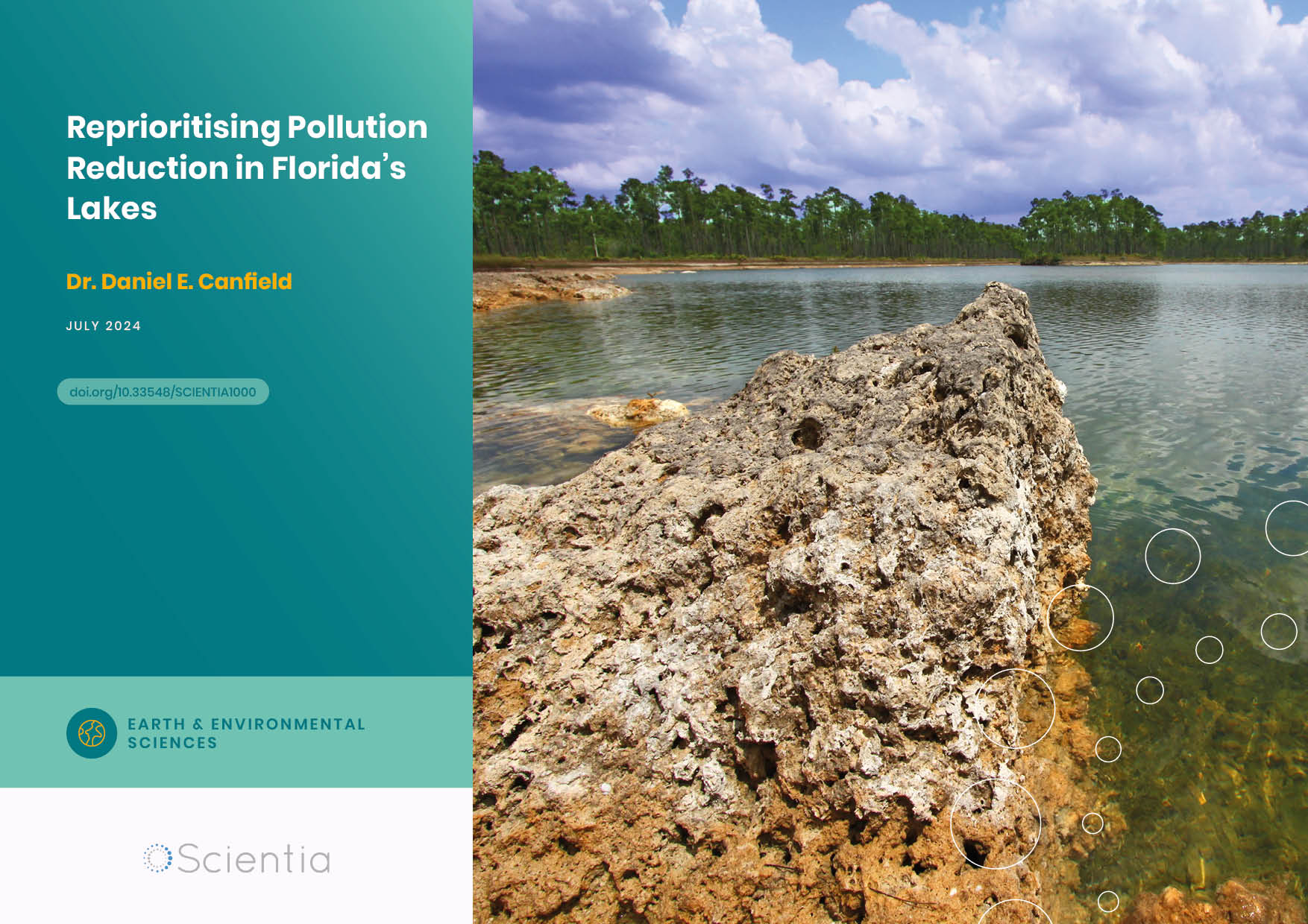
Dr. Daniel Canfield | Reprioritising Pollution Reduction in Florida’s Lakes
Florida’s landscape is dotted with thousands of lakes that reflect regional geology, topography and anthropogenic activities. Phosphorus and nitrogen are critical nutrients for maintaining the wide range of biological production expressed across Florida, but excessive inputs of these nutrients due to past human activities impair many waters. There has been a long history of work aiming to address associated water quality pressures, and Dr. Daniel Canfield at the University of Florida has been at the centre of these efforts for over 40 years. Now, with the correction of point-source nutrient inputs, Dr. Canfield proposes that holistic lake management, including the integration of in-lake management strategies with a focus on organic sediment removal, should be much more prominent on the US government’s agenda to provide faster restoration of stakeholders’ lake usability.

Dr Jon Tore Lieng | Dynamically Installed Anchors for Floating Offshore Turbines
Effectively harnessing offshore wind presents a valuable opportunity to increase energy supplies. Floating wind turbines present several advantages over traditional fixed turbines in more shallow waters. Dr Jon Tore Lieng from Deep Sea Anchors and colleagues have developed a type of dynamically installed anchor to hold the structures in place while reducing both the costs and complexity associated with installation where cohesive seabed sediments are realised.